17 kilometers
Camped by a creek just before the gate on the ATV road.
The distance of 17 kilometers does not even begin to describe the effort that today took. It was a challenging day climbing up 5 peaks and it took over 12 hours. It was a grand day and I’m sure it will be one of my favorite days of the entire hike. This is why I am out here.
Waking up to thunder, rain and howling wind added to the intensity of the day.
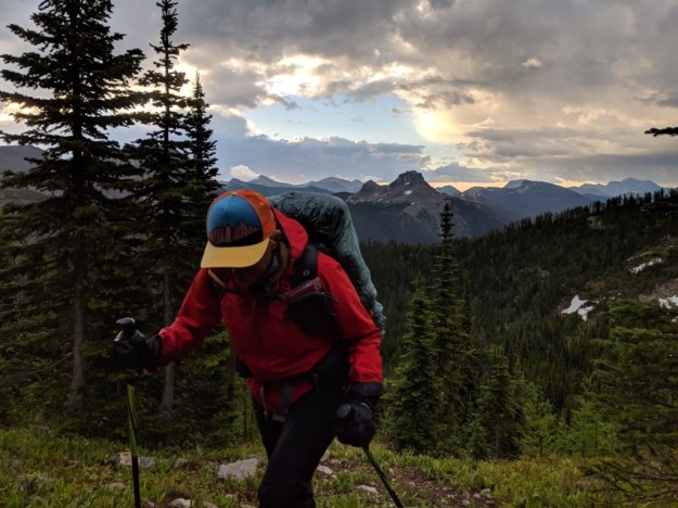
Head down, still dressed in rain gear the skies began to clear.
Only the wind ended up being a factor. Many times I had to stand with knees bent and both poles planted to keep from getting knocked down. It’s been smokey since we got to Canada and the wind blew it all away giving us super sharp views.
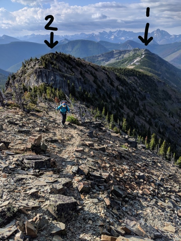
After the first two peaks we had the biggest one next… La Coulotte Peak

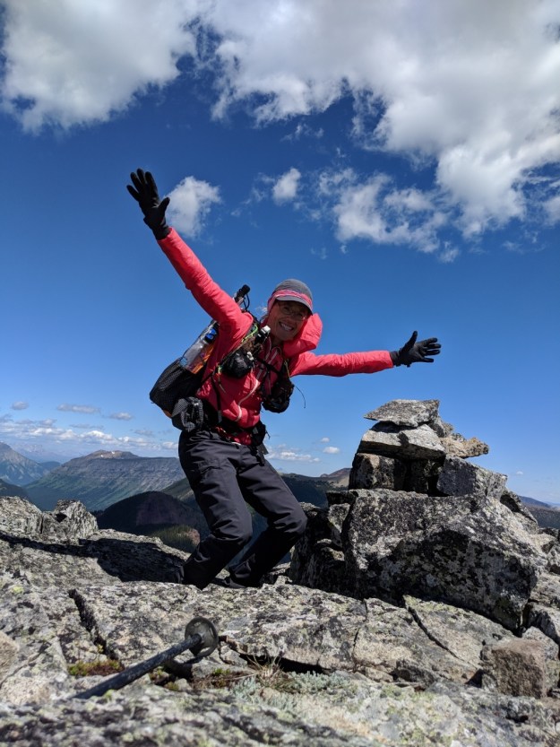
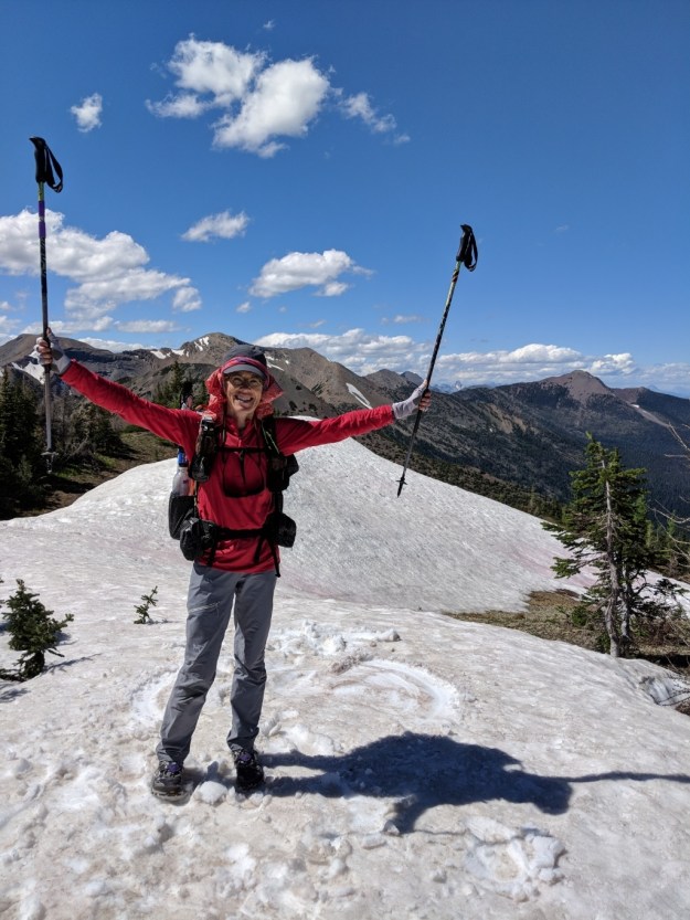
Flying high on La Coulotte Peak
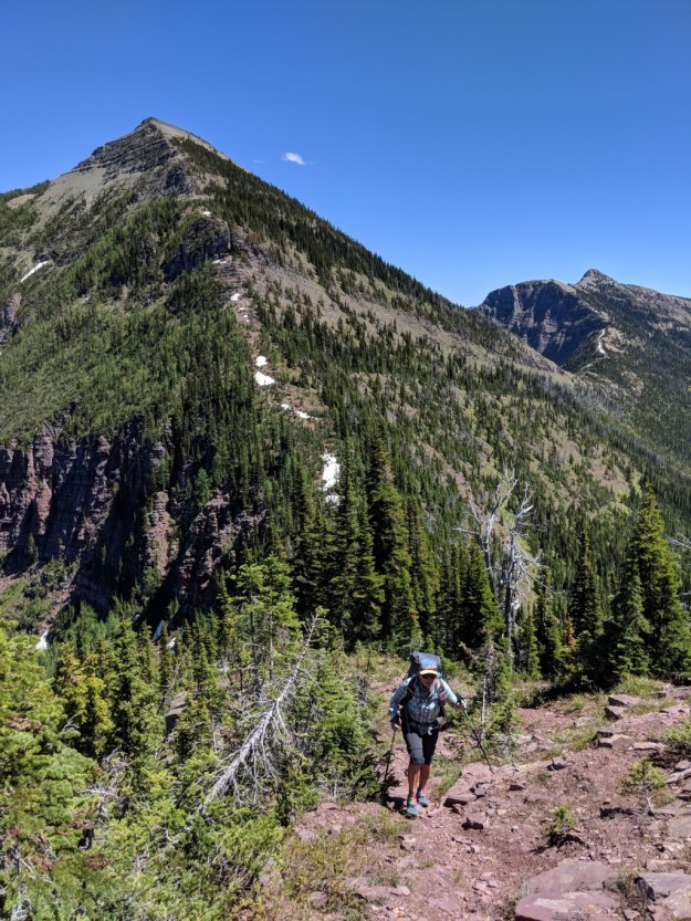
Rockin’ it’s on her way up #4 with La Coulotte Peak just behind her.

Almost up #5
On top of #5. Now we have a long way down.
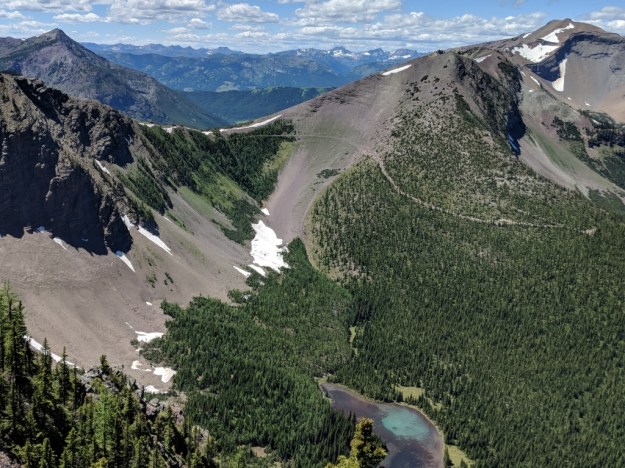
Our way out was down this ridge and onto the dirt road you can see in the distance.
After a bunch of miles down the road we stopped at a campsite next to a creek. What a day!

Hey Nancy, my husband Trey emailed you about the GR 20 hike- we’ve had some back and forth emails!
I’m excited to hear how this trek goes. The pictures are spectacular. Very inspiring! Susie
You need to put this one on your list. I hope the GR20 goes well for you. I want to hear about it. And with a name like fashionsausage I really want to meet you.
Amazing pictures! Thank you for including me in your list! Slow n Steady
Slow n Steady! What have you been doing?
Amazing photos! I think I should add this to my list too!! Happy hiking!!
-S’Rocket
Such incredible beauty. I’m loving following your adventure and the moments you capture to share.
Gorgeous pictures Nancy! For only 17k, that’s some tough terrain! You guys are flying!
You are going to love this hike
This looks incredible! Thanks for posting….onward!💛👍🏽🇨🇭
So many adventures still to do. As you well know. Ride on!
Beautiful photos! I am planning to hike the GDT next summer. La Coulotte Ridge is the part that scares me a bit. Do you have any advice for this section?
I’m sorry it’s taken so long to get back to you. My advice is to get perfect weather! Ha, ha! La Coulotte Ridge was one of my favorite days. The day started with rain so I was apprehensive about how the day would turn out. The rain ended and the wind picked up. We were worried about getting blown over the edge. The views were amazing. I hope you get at least as good of day as we got. I would advise looking at the maps to see where possible escape routes are. I would not want to be that high and exposed in a storm. If you can’t figure out a lower route ask Dan Durston on the Facebook GDT page or his blog intocascadia.com. He knows the GDT better than anyone I know. Are you blogging or instagramming?